The San Francisco Marathon Mile 9: Course Landmarks
The San Francisco Marathon Mile 9 STATS
Neighborhood: Marin Headlands
Elevation Change: Starts at 200’ and ends at 125’ (gradual descent)
Stations (water/food/toilet): Water approx. 8.5 mileBest
Best Spot for Family/Support: N/A Golden Gate Bridge Vista Point
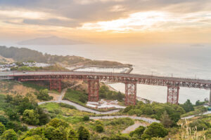
Runners will begin mile 9 of the SF Marathon before hitting landfall in Marin. The course leads directly to the Vista Point parking area. From there runners will be guided to the pedestrian path that takes them down to Alexander Ave. toward Sausalito. Once the path joins Alexander Ave runners an expect a downhill descent , from the shoulder of the road, down hill, until reaching East Road.

This quick downhill 9th mile ends when at the entrance of Bunker Hill Road. Off to the left is a one way tunnel. On the other side of that tunnel are the beautiful Marin Headlands, once the home of Battery Townsley and Nike Missiles but now home to the Marin Mammal Center, artist studios, wild life, hiking trails and amazing views. A visit to this area is a must for any San Francisco tourist to get. a full understanding of the area’s involvement in the Cold War and its evolvement to the wildlife center it is today.
Watch Mile 9 video below and then let’s continue through this gorgeous area as we venture into mile 10 of the course. Click Next Mile…
Neurun is a course visualization app that equips you with the course knowledge and confidence to achieve your goals at The San Francisco Marathon. Download to start visualizing now.
Sponsored By


