The Biofreeze San Francisco Marathon Course: Mile 26

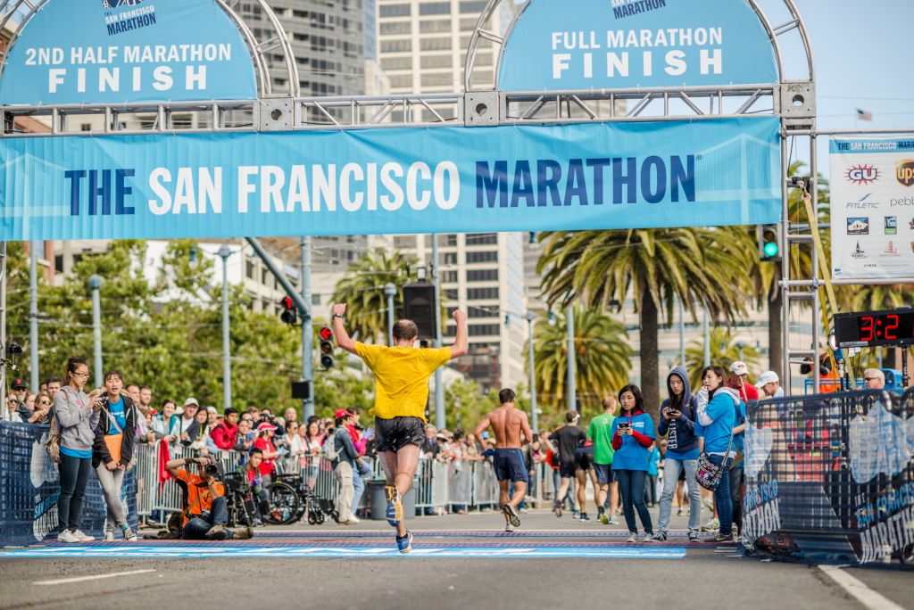
The home stretch! Mile 26 takes runners through the South of Market District, passing AT&T Park, stretching along the Embarcadero, past the Bay Bridge, and ending at Folsom Street.
The last mile begins at China Basin Park, a rectangular green patch of grass across the street from the stadium with ballpark and water views. It lines McCovey Cove, the unofficial name of a section of San Francisco Bay beyond the right field wall of AT&T Park, named after Giants first baseman Willie McCovey, who had 1,388 runs batted in and 469 home runs in his 2,256-game career with the Giants. On game days, fans take to the water of McCovey Cove in boats and even in kayaks, often with fishing nets in hopes of snagging a home run ball. “Splash hits” are recorded when Giants players hit home runs that land in McCovey Cove on the fly. These hits are tallied on an electronic counter on the right field wall. As of September 2014, 68 splash hits had been hit into the bay by Giants players since the park opened; 35 of those were by Barry Bonds, including his 500th home run.
Turning right back on to 3rd Street, runners head over the historic drawbridge, Lefty O’Doul Bridge, named after the power-hitting New York Giant who managed the San Francisco Seals from 1935 to 1951. The bridge was built in 1933 and designed by the Strauss Engineering Corporation, the same group that designed the Golden Gate Bridge.
Runners looking to their left can see the colorful houseboats of Mission Creek/China Basin Water Channel. This is also a popular spot for visitors and locals alike to explore the city’s waterfront by kayak.
Once runners wrap around the ballpark, they head out on the waterfront Embarcadero for the final stretch. There’s a wide sidewalk here, and it’s a nearly straight shot to the finish with incredible views.
The courses stretches through the South Beach and SOMA neighborhoods at this mile, which encompass blocks and blocks of high rise office buildings, and live/work lofts, as well as hotels, waterfront restaurants, bars, nightclubs and art galleries.
The $4.5 billion Transbay Transit Center, a massive transportation complex aiming to become the “Grand Central Station of the West,” is under construction here and scheduled to open in 2017.

One Rincon Hill can be seen from almost anywhere around here, one of the tallest all-residential structures west of the Mississippi, and one of the most significant additions to the San Francisco skyline since the 1970s. One Rincon, on 1st Street between Bryant and Harrison streets, stretches 60 stories and 605 feet above the bay (that’s taller than the Washington Monument). The building reflects the Bay Area’s penchant for technology: A water tower on top balances it in earthquakes, and it indicates forecasted weather through 25 multi-colored LED lights.
On a smaller scale Red’s Java House is a much-loved San Francisco institution at Pier 30.
Runners should be sure to look up as they pass under the dramatic, steel beams of the Bay Bridge, just before the San Francisco Marathon ends at Folsom Street in the midst of a screaming crowd.
About the author
Erin Mara is a writer and runner living in San Francisco. Her favorite city runs, along with her trusted training buddy, Izzy, include the Bay Trail from Fort Mason to the Golden Gate Bridge; Golden Gate Park out to Ocean Beach; and the Bay Area Ridge Trail, through the Presidio and out to the California Coastal Trail and Baker Beach – where she recently got engaged mid-run at the Pacific Overlook.


